The Local Environment
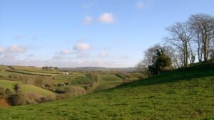
The most striking and singular feature of the Bere Peninsula’s natural environment is reflected in the very name ‘Bere’. It is derived from a Celtic word meaning ‘peninsula’ or ‘spit of land’. Apart from its relatively narrow northern limits, the parish is bounded by water, most of it tidal. This long ‘water frontier’ has affected our settlement and land use over many centuries, and is still an important current and future influence, for better and possibly for worse. Our peninsular status has given us our scenic beauty, individuality and insulation from ‘overdevelopment’, but also makes road communication awkward in most directions. Our topography is also central to the distinctive character of the Bere landscape, which features deep valleys and steep slopes, etched by the encircling Tamar and Tavy rivers and their tributary streams.
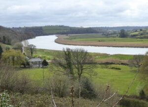
The Bere Peninsula is composed of ‘Upper Devonian’ rocks, which are over 360 million years old. Devonian slate rocks are especially widespread; they form the stony ‘shillet’ so familiar on farmlands and in gardens in the peninsula. Since its formation in seas around the Equator, millions of years of turbulent change affected the section of the Earth’s crust that became ‘Bere’ as it drifted north – volcanic activity, mountain-building, erosion, burial by the sea, re-emergence, folding and fracturing and more erosion. The striking meanders of the rivers, such as the big loop of the Tamar around the Hooe Peninsula, were probably laid out on an ancient river floodplain. Later, the land was pushed up when the Alps were being formed, leaving the meanders ‘incised’ in their valley.
Although our physical landscape evolved over millions of years, it was finally moulded during the ice ages, which were relatively ‘recent’ in geological terms. During the last glaciation conditions were harsh; it is now recognised that Dartmoor even had its own ice cap (but no true glaciers). In spring, meltwater from ice and heavy snow, especially on Dartmoor, would have raced over frozen subsoil en route to a sea that was at a much lower level than today (the mouth of the ‘Tamar’ was out near the Eddystone). Powerful floods scoured their way down deep, bare valleys. Then, as the climate warmed and the ice retreated globally around 12,000 years ago, sea levels rose and the deepest valleys were drowned by rising sea levels, thus creating the Tamar and Tavy estuaries. Gradually, these drowned valleys were then partly filled by sediment washed down from erosion upstream.
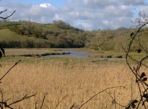
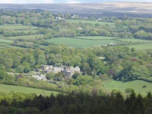
 All these dramatic earth processes have left us a splendidly diverse and attractive physical environment, and important natural habitats. Such influences as slope, aspect and proximity to the rivers support different vegetation types and land uses. Steep valley-side woodlands, such as those that flank the Tavy Valley above Lopwell, contrast with salt marshes and reedbeds on the shorelines, or the plateau areas south and east of Bere Alston, which are echoes of past higher sea levels.
Like most of Britain, the environment of the Bere Peninsula has been altered by thousands of years of human activity; it is an intimate blend of ‘nature’ and people. Although the inter-tidal zone in the estuaries, the marshes and some of the woodland might be considered ‘semi-natural’, most of the landscape has been managed and adapted to human needs over a long period, especially through farming. The dominant land use in terms of area has long been pasture and livestock raising, although arable production also has a long history on the peninsula. Generally, the soils are relatively acid, rather stony and thin. As farm production became more intensive and commercial horticulture developed in the 19th century, it became essential to boost soil fertility with lime, manures and other fertilisers – an intervention in the ‘natural’ environment that continues today.
Centuries of land management have altered the landscape in other ways, adding to the range of habitats, including the miles of hedgerows, woodland and rough pasture. The interface between land and water, so characteristic of the Bere Peninsula has also been changed: for example, short creeks leading from the estuaries have been dammed. An example is the ‘marsh’ at Bere Ferrers, which was originally dammed in conjunction with a long-vanished tide mill. Small quays were built on the Tamar and Tavy shores, as at Bere Ferrers, Hole’s Hole, Weir Quay and Butspill, while the railway viaduct over the Tavy and Denham Bridge have moderated, but not overwhelmed our peninsular status.
As elsewhere in the Tamar Valley, mining has been very important on the Bere Peninsula, which is underlain by several lead-silver ore lodes. A remarkable medieval silver-mining industry flourished here in the late 13th, early 14th and mid-15th century (further sources on medieval silver mining). Mining (for lead) returned on much larger scale towards the end of the 18th century and continued into the 1860s. Traces of both of these mining phases can still be found. Past mining activity was also very important in shaping today’s the settlement pattern. Bere Alston grew as a hilltop service centre for the medieval silver industry, greatly expanding the existing small hamlet. The lead mining boom in the middle of the 19th century brought rapid population growth, especially in Bere Alston, and to a lesser extent, in Bere Ferrers, and around Weir Quay and Cotts.
Although far less influential than mining, stone has also been quarried on the peninsula. Small quarries produced slate (for example, above Liphill Creek) and resilient volcanic felsite stone was taken from narrow outcrops on Vinegar Hill above Bere Ferrers (used for buildings including Bere Ferrers Church Hall and houses on Tap Hill, Bere Alston).
The Bere Peninsula has been influenced by its physical environment in other ways. The proximity of tidal water, as well as the wider regional setting, ensures a relatively mild climate, so that frost is less of a hazard for agriculture and horticulture. Although our peninsular status has perhaps constrained development and population growth, the high visual quality and diversity of the landscape and its habitats make the area potentially very attractive as a place to live and to visit.
The value and vulnerability of the environment is recognised by the conservation status of the peninsula. Certain areas are included in the Tamar-Tavy Estuary Site of Scientific Interest (SSSI), particularly mudflats, reedbeds and saltmarshes, which host important wildlife communities. The whole of the peninsula has been designated as part of the Tamar Valley Area of Outstanding Natural Beauty (AONB).
 Our immediate physical environment cannot be detached from our wider surroundings. Part of the appeal of the Peninsula comes from the views beyond – across the rivers or out to the granite upland horizons Dartmoor, the Hingston Down-Kit Hill ridge and Bodmin Moor. At the regional scale, the Bere Peninsula is embedded in the wider ‘Far South West’, with its contradictory interplay of a magnificent physical environment and relative isolation. But our engagement with the ‘physical environment’ is now global. We depend on a vast array of distant resources that are extracted from land and sea, processed and transported. All these materials are consumed – and may become ‘waste’ that is disposed of, be it via properly-managed sites or into the surrounding waters and atmosphere.
